Discover the enchanting world of antique maps & vintage prints.
We are dealers in rare, antique & authentic maps and prints of all parts of the world, published from the 16th to the 20th centuries. We only sell authentic, original items - a Certificate of Authenticity comes with every order. We are based in London and offer fast worldwide shipping
Shop the Largest
Range of Authentic Antique Maps & Prints online.
Our catalogue of over 80,000 items spans everything from rare discoveries to affordable gems. Explore nautical and astronomical charts, city plans, military, fantasy, pictorial, and wine maps — plus topographical views and animals, bird and botanical prints. We’re particularly strong in maps of London, British Isles counties, US states, French departments, and Vanity Fair "Spy" cartoons.
Shop Recent Highlights


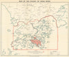


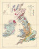
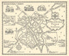
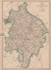
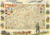
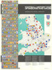
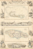
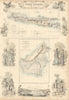
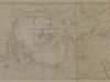
![Midle-sex [with] London & Westminster. Speed county map. Bassett & Chiswell 1676](http://www.antiquemapsandprints.com/cdn/shop/files/P-8-005947a_d6835bdb-bc05-4eb7-9635-a2fe3da32def.jpg?v=1753354614&width=3000)
![Midle-sex [with] London & Westminster. Speed county map. Bassett & Chiswell 1676](http://www.antiquemapsandprints.com/cdn/shop/files/P-8-005947a_d6835bdb-bc05-4eb7-9635-a2fe3da32def_100x100.jpg?v=1753354614)
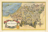
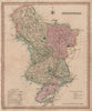
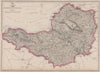
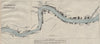
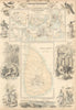
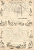
![Midle-sex [with] London & Westminster. John Speed county map. Overton 1710](http://www.antiquemapsandprints.com/cdn/shop/files/P-8-005948a_800933ce-152f-4b02-888c-2860759716b4.jpg?v=1753354614&width=3000)
![Midle-sex [with] London & Westminster. John Speed county map. Overton 1710](http://www.antiquemapsandprints.com/cdn/shop/files/P-8-005948a_800933ce-152f-4b02-888c-2860759716b4_100x100.jpg?v=1753354614)


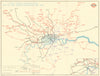


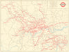


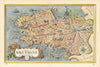
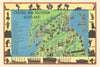
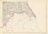
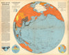
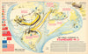
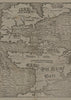
![The Arctic Regions showing the North-West Passage [per] McClure c1863 old map](http://www.antiquemapsandprints.com/cdn/shop/files/P-8-005875a.jpg?v=1752087477&width=3000)
![The Arctic Regions showing the North-West Passage [per] McClure c1863 old map](http://www.antiquemapsandprints.com/cdn/shop/files/P-8-005875a_100x100.jpg?v=1752087477)


Maps are endlessly fascinating - in their unexpected details, and the way they illuminate moments in history.
Maps are endlessly fascinating - in their unexpected details, and the way they illuminate moments in history.
A Family Business - Antiquarian Map Dealers for 50 years.
I’m Richard, an antique map dealer like my father before me. For me, it’s never felt like work — each day brings the thrill of travelling vicariously through place and time. I’m passionate about unearthing the unusual, eclectic and long-forgotten so we can offer you the largest selections anywhere — from rare discoveries to affordable gems. We're proud to supply collectors, museums, archives, interior designers, gift seekers, and fellow dealers alike


Maps are endlessly fascinating - in their unexpected details, and the way they illuminate moments in history.

A map or print can celebrate your roots or evoke a cherished memory. Whether for yourself or as a gift, we're sure you'll find something to treasure.
Any questions? Get in touch – We’re here to help!
Need help finding something special or want to know more? We're here to assist — whether you're looking for advice on collecting, caring for, or investing in antique maps and prints. Want to see before you buy? Contact us to arrange a viewing — we regularly welcome both curious locals and overseas visitors. Have something to sell? We buy books, maps, and atlases