
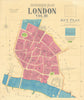


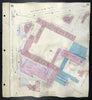


Bank vaults, newspaper presses and riverside warehouses fill Charles Goad’s fire insurance maps of the City of London. These original plans record the Square Mile building by building, from St Paul’s, Fleet Street and Smithfield to the Bank, Liverpool Street and Aldgate. Livery halls and churches stand among commercial premises, while bomb-damaged plots and pasted corrections trace rebuilding and changing occupiers. Early- and mid-twentieth-century sheets, many updated into 1969–70, reveal the working City before today’s skyline.
EU orders up to €150 are sent VAT- and duty-paid — no additional taxes on arrival
Authenticity Guaranteed - We only sell original antique & vintage items
Can we help? Call us on +44-208-960-3476 • FAQs
All our products are exempt from US tariffs — no additional duties or taxes payable on arrival.


- Shop by Country
- Shop by Cartographer
- Shop Maps by Type
- Shop Prints by Subject