


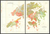


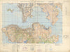
Antique and vintage maps of Kowloon trace its streets, waterfront and expanding urban districts. Chinese-language plans of Yau Ma Tei and the peninsula sit alongside Sun Sun’s bilingual street maps, Admiralty harbour charts and detailed Hong Kong Government surveys. Coverage includes Tsim Sha Tsui, Mong Kok, Hung Hom, Ma Tau Wai, To Kwa Wan and Kai Tak, with railway land, reclamation schemes and industrial shorelines recorded at different dates.
EU orders up to €150 are sent VAT- and duty-paid — no additional taxes on arrival
Authenticity Guaranteed - We only sell original antique & vintage items
Can we help? Call us on +44-208-960-3476 • FAQs
All our products are exempt from US tariffs — no additional duties or taxes payable on arrival.


- Shop by Country
- Shop by Cartographer
- Shop Maps by Type
- Shop Prints by Subject