Hide out of stock items


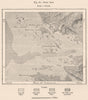

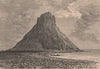

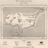

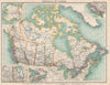


Antique maps & old prints of Alaska and Russian America. We stock early state maps by Buchon from "Deux Ameriques" (1825), "Encyclopedia Britannica" state maps (1898 & 1903), 19th century engravings from the "Illustrated London News", prints & sketch maps from "Universal Geography" by Elisee Reclus (1885), halftone prints from "Voyage a Travers d'Amerique" (1895), "Encyclopaedia Americana" maps and plans, decorative maps of the states and territories of the United States from Colton's "General Atlas" (1863) and "Octavo Atlas of the Union" (1864), from Arrowsmith & Lewis's "New and Elegant General Atlas" (1812), and from Rand McNally's "Unrivaled Atlas" (1912).