Hide out of stock items

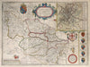
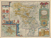
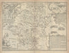
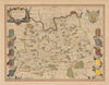
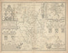
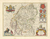
![Midle-sex [with] London & Westminster. John Speed county map. Overton 1710](http://www.antiquemapsandprints.com/cdn/shop/files/P-8-005948a_800933ce-152f-4b02-888c-2860759716b4.jpg?v=1753354614&width=3000)
![Midle-sex [with] London & Westminster. John Speed county map. Overton 1710](http://www.antiquemapsandprints.com/cdn/shop/files/P-8-005948a_800933ce-152f-4b02-888c-2860759716b4_100x100.jpg?v=1753354614)
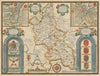
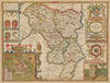
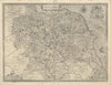
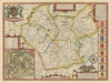
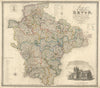
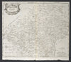
![Midle-sex [with] London & Westminster. Speed county map. Bassett & Chiswell 1676](http://www.antiquemapsandprints.com/cdn/shop/files/P-8-005947a_d6835bdb-bc05-4eb7-9635-a2fe3da32def.jpg?v=1753354614&width=3000)
![Midle-sex [with] London & Westminster. Speed county map. Bassett & Chiswell 1676](http://www.antiquemapsandprints.com/cdn/shop/files/P-8-005947a_d6835bdb-bc05-4eb7-9635-a2fe3da32def_100x100.jpg?v=1753354614)


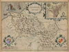

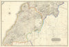

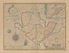

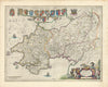


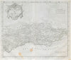


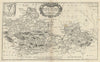

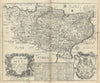

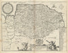
We stock an enormous selection of maps of the counties of England, Scotland, Ireland and Wales. Filter by Region to select the county you are looking for. We have maps by over 60 cartographers including George Washington Bacon, George Philip, John Cary, Creighton & Walker, Robert Morden, John Speed, Joan Blaeu, Emanuel Bowen, Thomas Moule, Antonio Zatta, Daniel Lizars, Badeslade & Toms, from atlases including Camden's Britannia, Cary's New & Correct English Atlas, Britannia Depicta, Chorographia Britanniae, The Theatre of the Empire of Great Britaine, Moule's English counties delineated, Philip's Handy Atlas of the Counties of England, Thomson's Atlas of Scotland, & Scalé's Hibernian Atlas.