


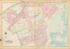


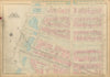

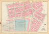

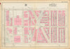

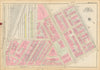


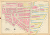

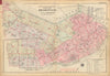

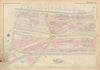

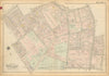


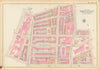

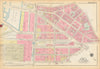

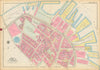

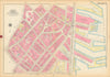


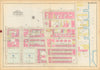

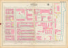


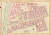

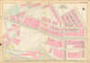

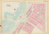

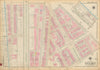

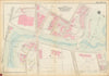

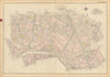

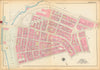

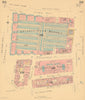

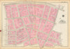

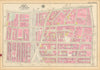

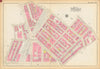

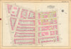

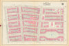
Our collection of insurance maps — including examples by Charles Goad, G.W. Bromley, and the Sanborn-Perris Map Co. — offers an extraordinary record of urban development, land use, and building detail in the late 19th and early 20th centuries. Originally created for fire insurance risk assessment, these maps meticulously document construction materials, property boundaries, street layouts, and the footprint of nearly every structure in dense urban areas. Our holdings include detailed coverage of parts of London, New York City, Philadelphia & Bristol. These large-scale plans are not only highly technical and precise but also visually striking — often hand-coloured and annotated — and today serve as invaluable resources for architectural historians, urban researchers, and collectors of city cartography.
EU orders up to €150 are sent VAT- and duty-paid — no additional taxes on arrival
Authenticity Guaranteed - We only sell original antique & vintage items
Can we help? Call us on +44-208-960-3476 • FAQs
All our products are exempt from US tariffs — no additional duties or taxes payable on arrival.
- Shop by Country
- Shop by Cartographer
- Shop Maps by Type
- Shop Prints by Subject