


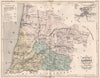


French departments are mapped with their settlements, roads and terrain, and with inset plans of capitals such as Dijon, Grenoble, Limoges and Montauban, in Atlas de la France Illustrée, Auguste Henri Dufour's atlas published by Gustave Barba in Paris in 1852. National maps set the departments within France's provinces, transport network and river basins, and thematic sheets cover communications, industrial districts and the limits of crops such as vines and olives. The colonial maps reach beyond metropolitan France to the Caribbean, West Africa, the Indian settlements and islands in the Indian Ocean and the Pacific.
EU orders up to €150 are sent VAT- and duty-paid — no additional taxes on arrival
Authenticity Guaranteed - We only sell original antique & vintage items
Can we help? Call us on +44-208-960-3476 • FAQs
All our products are exempt from US tariffs — no additional duties or taxes payable on arrival.


- Shop by Country
- Shop by Cartographer
- Shop Maps by Type
- Shop Prints by Subject