


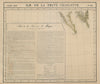


Russian America, Greenland and the Canadian Arctic are drawn at the same scale as Cuba and Jamaica in these maps from the North America volume of Atlas universel, Philippe Vandermaelen's Brussels atlas of 1827. Lithographed by Henri Ode, the atlas was designed as one continuous geographical framework, so remote northern shores take up as much room as the settled districts. Northern sheets follow Hudson Bay and the Arctic coasts, others cover the St Lawrence, the eastern United States and Mexico, and the West Indies run through Puerto Rico and the smaller islands. Names such as Nouvelle Bretagne and Amérique Russe date the maps before Canada's provinces and the transfer of Alaska to the United States, and the varying detail shows how unevenly the coasts had been surveyed.
EU orders up to €150 are sent VAT- and duty-paid — no additional taxes on arrival
Authenticity Guaranteed - We only sell original antique & vintage items
Can we help? Call us on +44-208-960-3476 • FAQs
All our products are exempt from US tariffs — no additional duties or taxes payable on arrival.


- Shop by Country
- Shop by Cartographer
- Shop Maps by Type
- Shop Prints by Subject