


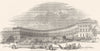

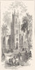


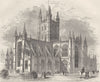

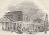
Explore antique maps and prints of Bath, from eighteenth- and nineteenth-century city plans and surveys of the Roman Baths to views of Bath Abbey, the Pump Room, Royal Crescent, Pulteney Bridge, Bathwick, Widcombe and the surrounding Avon valley. Cartographers and artists represented include Thomas Moule, Robert Dawson, George Bacon, Baedeker, Ward Lock, Patrick Abercrombie, Ernest Haslehust and the Geological Survey, alongside regional maps of Bristol, the Mendips and the southern Cotswolds.
EU orders up to €150 are sent VAT- and duty-paid — no additional taxes on arrival
Authenticity Guaranteed - We only sell original antique & vintage items
Can we help? Call us on +44-208-960-3476 • FAQs
All our products are exempt from US tariffs — no additional duties or taxes payable on arrival.


- Shop by Country
- Shop by Cartographer
- Shop Maps by Type
- Shop Prints by Subject