


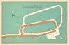


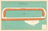

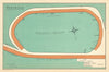


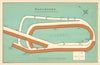


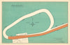
Every plan here comes from F.H. Bayles's Race Courses Atlas of Great Britain and Ireland, with sheets dated 1903 that map the geography of racing itself. They take in Newmarket Heath, Ascot, Sandown and Kempton, and in Ireland the Curragh, Leopardstown and Punchestown. Each plan shows the shape and setting of its ground, whether the town moor at Doncaster, the Roodee at Chester or the upland site at Goodwood, and several record courses since closed or moved, including Gatwick, Hurst Park, Castle Irwell and the earlier Ayr course.
EU orders up to €150 are sent VAT- and duty-paid — no additional taxes on arrival
Authenticity Guaranteed - We only sell original antique & vintage items
Can we help? Call us on +44-208-960-3476 • FAQs
All our products are exempt from US tariffs — no additional duties or taxes payable on arrival.


- Shop by Country
- Shop by Cartographer
- Shop Maps by Type
- Shop Prints by Subject