


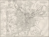


Seaside resorts, waterfalls and the railways that carried Victorian travellers to them appear in these maps and prints from Black's guide to England & Wales, published in Edinburgh by Adam and Charles Black in 1874. The maps range from county coverage to railway routes such as the Great Eastern corridor between London, Ipswich, Bury St Edmunds and Norwich, showing how the stages of a tour connected rather than simply setting out political divisions. The prints show the destinations themselves, from Hastings and Lancaster to Epsom racecourse and the waterfalls at Rydal.
EU orders up to €150 are sent VAT- and duty-paid — no additional taxes on arrival
Authenticity Guaranteed - We only sell original antique & vintage items
Can we help? Call us on +44-208-960-3476 • FAQs
All our products are exempt from US tariffs — no additional duties or taxes payable on arrival.


- Shop by Country
- Shop by Cartographer
- Shop Maps by Type
- Shop Prints by Subject