


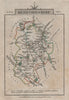

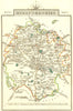


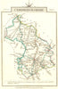


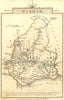

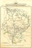

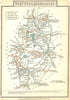

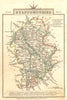


Turnpike roads and county outlines make Cary's Traveller's Companion a compact record of travel before the railway age. These maps come from editions dated 1806–1814 of John Cary's London publication, subtitled A Delineation of the Turnpike Roads of England and Wales. Small county sheets show the road network within clear boundaries, with rivers and towns as landmarks along the way, and separate maps cover northern and southern Wales. Kent, Essex, Lancashire, Devon and the Midland counties show the range, while the Isle of Wight and the tourist districts around Bath and Thanet add more local coverage, all in a pocket format made to travel.
EU orders up to €150 are sent VAT- and duty-paid — no additional taxes on arrival
Authenticity Guaranteed - We only sell original antique & vintage items
Can we help? Call us on +44-208-960-3476 • FAQs
All our products are exempt from US tariffs — no additional duties or taxes payable on arrival.


- Shop by Country
- Shop by Cartographer
- Shop Maps by Type
- Shop Prints by Subject