


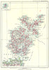


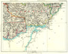


Rivers, hills, bays and routes, rather than county outlines, divide the British Isles into manageable regions in the maps from Cassell's Gazetteer of Great Britain & Ireland, published by Cassell and Company and dated 1893. One sheet joins Salisbury Plain with the Hampshire Downs, another brings the South Downs and Surrey Hills into a single frame, and the Clyde is mapped through Glasgow and its surrounding settlements. Coastal sheets follow the Yorkshire shore, Cardigan Bay and the Severn estuary, while Scottish island groups and Irish provinces carry the gazetteer well beyond England. London, the Midlands and industrial northern England appear alongside Highland and Atlantic landscapes.
EU orders up to €150 are sent VAT- and duty-paid — no additional taxes on arrival
Authenticity Guaranteed - We only sell original antique & vintage items
Can we help? Call us on +44-208-960-3476 • FAQs
All our products are exempt from US tariffs — no additional duties or taxes payable on arrival.


- Shop by Country
- Shop by Cartographer
- Shop Maps by Type
- Shop Prints by Subject