


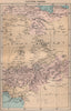


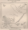

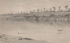

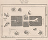

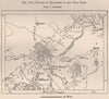


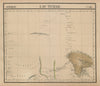
Lake Chad and the rivers that feed it are the focus of this collection, which reaches well beyond the borders of the modern country. The maps include explorers' route maps, Vandermaelen's African atlas sections and mapping of Kanem, Borkou and Tibesti, with nineteenth-century sheets linking the lake basin to Borno, northern Cameroon and the Sahara. Colonial maps of Ubangi-Shari and French Equatorial Africa, then twentieth-century national maps and flags, record later political divisions. The prints show the Chari, the shores of the lake, the palace at Massenya and communities described in the publications of the time as Kanembu or Toubou, in the terms of those accounts.
EU orders up to €150 are sent VAT- and duty-paid — no additional taxes on arrival
Authenticity Guaranteed - We only sell original antique & vintage items
Can we help? Call us on +44-208-960-3476 • FAQs
All our products are exempt from US tariffs — no additional duties or taxes payable on arrival.


- Shop by Country
- Shop by Cartographer
- Shop Maps by Type
- Shop Prints by Subject