


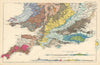




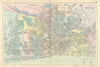


Railways, parliamentary boundaries and town plans make the Commercial & Library Atlas of the British Isles a detailed record of the late Victorian country. The atlas was edited by George Washington Bacon and published by G. W. Bacon & Co. in London, and the editions here date from the closing years of the nineteenth century. National and regional sheets sit beside plans of towns and their surroundings, including Dundee and the Firth of Tay, Dublin and Killarney; Irish sheets distinguish northern and southern districts, and northern English maps follow the linked industrial centres of Liverpool, Manchester, Leeds and Newcastle.
EU orders up to €150 are sent VAT- and duty-paid — no additional taxes on arrival
Authenticity Guaranteed - We only sell original antique & vintage items
Can we help? Call us on +44-208-960-3476 • FAQs
All our products are exempt from US tariffs — no additional duties or taxes payable on arrival.


- Shop by Country
- Shop by Cartographer
- Shop Maps by Type
- Shop Prints by Subject