


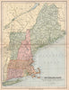


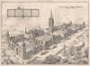




Long Island Sound, the Connecticut River and the buildings of Yale give these maps and prints of Connecticut their varied setting. State sheets by Arrowsmith and Lewis, Colton, Johnson, Buchon and later publishers sit beside road, railway and coastal triangulation maps, and wider New England plates show the state with Massachusetts, Rhode Island and New York. The prints follow Hartford, New Haven, New London and smaller riverside towns, from the State Capitol and Colt's factory to oyster boats at Norwalk. Yale appears in architectural views, campus scenes and a bird's-eye prospect by Richard Rummell, while William Henry Bartlett's landscapes turn to river bridges, Canaan and the Housatonic.
EU orders up to €150 are sent VAT- and duty-paid — no additional taxes on arrival
Authenticity Guaranteed - We only sell original antique & vintage items
Can we help? Call us on +44-208-960-3476 • FAQs
All our products are exempt from US tariffs — no additional duties or taxes payable on arrival.


- Shop by Country
- Shop by Cartographer
- Shop Maps by Type
- Shop Prints by Subject