


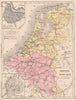


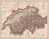


Rainfall, watersheds, agriculture, industry and minerals are all mapped for France in these distinctly thematic sheets by Pierre François Cortambert. The family label refers to Eugène Pierre François Cortambert, the geographer who lived from 1805 to 1881, and the associated Cortambert publishing tradition; his son Richard lived from 1836 to 1884. The sheets are dated 1880 and come from an Atlas de Géographie published by Hachette in Paris under E. Cortambert's name. French maps also compare the old provinces with the departments and set out administrative systems, while wider sheets cover the continents, colonial territories and historical empires.
EU orders up to €150 are sent VAT- and duty-paid — no additional taxes on arrival
Authenticity Guaranteed - We only sell original antique & vintage items
Can we help? Call us on +44-208-960-3476 • FAQs
All our products are exempt from US tariffs — no additional duties or taxes payable on arrival.


- Shop by Country
- Shop by Cartographer
- Shop Maps by Type
- Shop Prints by Subject