


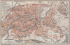


Germany on the eve of the First World War is laid out for the traveller in these maps from Deutschland in einem Bande, the third edition of Baedeker's guide, published in 1913. City plans cover the streets of Hamburg, Munich, Dresden and Frankfurt, the industrial centres of Essen and Dortmund and the interiors of Berlin's museums. Rhine sections follow the river between Bonn, Koblenz and Bingen, and mountain maps open up the Harz, the Black Forest and Saxon Switzerland. In the east, Danzig, Stettin and Königsberg appear under their German names, the south-west includes Alsace-Lorraine, and excursions reach towards Salzburg and Bohemia.
EU orders up to €150 are sent VAT- and duty-paid — no additional taxes on arrival
Authenticity Guaranteed - We only sell original antique & vintage items
Can we help? Call us on +44-208-960-3476 • FAQs
All our products are exempt from US tariffs — no additional duties or taxes payable on arrival.


- Shop by Country
- Shop by Cartographer
- Shop Maps by Type
- Shop Prints by Subject