


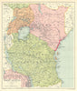


Great lakes, coastal trading routes and a succession of colonial territories shape these maps of East Africa, which range from early depictions of Abyssinia and the Zanzibar coast to surveys of Tanganyika, the railways of Kenya and Uganda and twentieth-century economic maps. Royal Geographical Society material records journeys between the lakes and rivers and proposed communications, while Royal Commission sheets compare land, population, rainfall and the spread of tsetse fly. Regional maps often reach into the Sudan, southern Arabia or south-eastern Africa. Among the prints are scenes on Lake Tanganyika, customs work at Quelimane and views of the Morrumbala marshes.
EU orders up to €150 are sent VAT- and duty-paid — no additional taxes on arrival
Authenticity Guaranteed - We only sell original antique & vintage items
Can we help? Call us on +44-208-960-3476 • FAQs
All our products are exempt from US tariffs — no additional duties or taxes payable on arrival.


- Shop by Country
- Shop by Cartographer
- Shop Maps by Type
- Shop Prints by Subject