


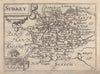


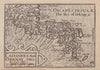


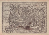


Small engraved county maps put the geography of John Speed into a portable early seventeenth-century form in England, Wales, Scotland and Ireland Described and Abridged. George Humble sold the compact work in London from 1627, with mapping engraved by Pieter van den Keere from an earlier series and descriptions abridged from Speed's larger work; the impressions here date from 1627–1632. English counties make up most of the collection, with grouped Welsh counties, divisions of Scotland, Irish provinces and the principal islands. Old spellings and decorative lettering survive in the reduced format, though without the elaborate town plans of Speed's folio maps.
EU orders up to €150 are sent VAT- and duty-paid — no additional taxes on arrival
Authenticity Guaranteed - We only sell original antique & vintage items
Can we help? Call us on +44-208-960-3476 • FAQs
All our products are exempt from US tariffs — no additional duties or taxes payable on arrival.


- Shop by Country
- Shop by Cartographer
- Shop Maps by Type
- Shop Prints by Subject