


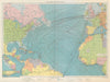


Eighteenth-century river charts trace the Gambia inland towards Eropina and Barrakunda as a route into the interior, and they form the backbone of these antique maps. Bellin, Schley and Kitchin connect its course with the Senegal river and the Senegambian country, and plans and views of Fort James, now associated with Kunta Kinteh Island, look closely at a fortified river site. Later maps show Bathurst, now Banjul, at the river's entrance and set the territory within British and French West Africa, while Survey Department mapping, maritime sheets and twentieth-century economic maps add further scales. The prints depict settlements, cotton plantations, an encampment and meetings between local rulers and the colonial governor.
EU orders up to €150 are sent VAT- and duty-paid — no additional taxes on arrival
Authenticity Guaranteed - We only sell original antique & vintage items
Can we help? Call us on +44-208-960-3476 • FAQs
All our products are exempt from US tariffs — no additional duties or taxes payable on arrival.


- Shop by Country
- Shop by Cartographer
- Shop Maps by Type
- Shop Prints by Subject