
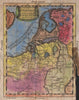

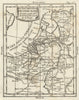

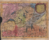
California drawn as an island, incomplete Australian coasts and imaginary features in Asia and Africa give the maps from Geografia Universale del P. Buffier their period charm. The work derives from Claude Buffier's geographical teaching and appeared in successive Italian editions; the edition here was published in Venice by Francesco Pitteri in 1788, with Giovanni Petroschi credited as engraver. Its compact sheets cover Europe, Asia, Africa and the Americas under historical names such as Muscovy and the Holy Roman Empire, while regional maps of Italy, the Rhine and the British Isles bring the scale closer.
EU orders up to €150 are sent VAT- and duty-paid — no additional taxes on arrival
Authenticity Guaranteed - We only sell original antique & vintage items
Can we help? Call us on +44-208-960-3476 • FAQs
All our products are exempt from US tariffs — no additional duties or taxes payable on arrival.


- Shop by Country
- Shop by Cartographer
- Shop Maps by Type
- Shop Prints by Subject