
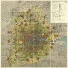


Green belts, satellite towns and four rings set out Patrick Abercrombie's blueprint for post-war London in the Greater London Plan 1944, published by HMSO in 1945. Its maps begin with the pressures behind the plan, charting population density, industrial growth, the age of housing and traffic flows, before turning to proposals for decentralisation and open space. Railway electrification, airports, arterial roads and footpaths appear alongside sewerage, water, gas and electricity, and local studies of West Ham, Canning Town, Hatfield and Chipping Ongar bring the scheme down to the scale of neighbourhood and town. The roads, layouts and densities shown were proposals, and not every scheme was built.
EU orders up to €150 are sent VAT- and duty-paid — no additional taxes on arrival
Authenticity Guaranteed - We only sell original antique & vintage items
Can we help? Call us on +44-208-960-3476 • FAQs
All our products are exempt from US tariffs — no additional duties or taxes payable on arrival.


- Shop by Country
- Shop by Cartographer
- Shop Maps by Type
- Shop Prints by Subject