
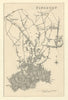





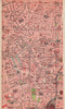

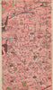






Copenhagen House, Highbury College and Charles Booth's poverty maps are among the treasures in these maps and prints of Islington. Earlier maps follow the parish of St Mary and its links with Highgate, Holloway and neighbouring districts, while later street plans join Highbury, Barnsbury and Tufnell Park to the growing capital, and Booth's social mapping records the conditions of particular streets. The prints show houses and civic buildings and views towards the City and East End, along with antiquarian material on inscriptions, arms and coins from the area's local histories, across sources from the eighteenth to the twentieth century.
EU orders up to €150 are sent VAT- and duty-paid — no additional taxes on arrival
Authenticity Guaranteed - We only sell original antique & vintage items
Can we help? Call us on +44-208-960-3476 • FAQs
All our products are exempt from US tariffs — no additional duties or taxes payable on arrival.


- Shop by Country
- Shop by Cartographer
- Shop Maps by Type
- Shop Prints by Subject