


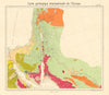


Petra's ruins, the Jordan Valley and the routes across Transjordan appear in these maps, which reach well beyond the outline of the modern country. Münster's Holy Land and later sheets by Arrowsmith, Tallis and the Society for the Diffusion of Useful Knowledge set the river, the Dead Sea and the uplands within biblical and regional frameworks, while plans of Petra, Jerash, Madaba and Amman's citadel focus on individual sites. Military maps record the raids on Amman and Es Salt, the river bridgeheads and Chaytor's operations in the Palestine campaign of 1918, and twentieth-century maps show the armistice lines. The prints show Petra, river crossings and the Dead Sea, including work associated with William Henry Bartlett.
EU orders up to €150 are sent VAT- and duty-paid — no additional taxes on arrival
Authenticity Guaranteed - We only sell original antique & vintage items
Can we help? Call us on +44-208-960-3476 • FAQs
All our products are exempt from US tariffs — no additional duties or taxes payable on arrival.


- Shop by Country
- Shop by Cartographer
- Shop Maps by Type
- Shop Prints by Subject