
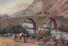


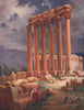
The cedars of Mount Lebanon, the ruins of Baalbek and the harbours of Tyre and Sidon recur through several centuries of mapping and illustrating the Levant. The maps range from early Holy Land and Syria sheets to harbour plans of Beirut, Tyre and Tripoli, Ottoman provincial maps and French mandate atlases, with detailed plans of Baalbek and Sidon, military maps of campaigns along the coast and Beirut city plans linking the port and bazaar with the road to Damascus. Older maps often set Lebanese territory within Syria or Palestine. The prints include views associated with Bartlett, Turner and Margaret Thomas.
EU orders up to €150 are sent VAT- and duty-paid — no additional taxes on arrival
Authenticity Guaranteed - We only sell original antique & vintage items
Can we help? Call us on +44-208-960-3476 • FAQs
All our products are exempt from US tariffs — no additional duties or taxes payable on arrival.


- Shop by Country
- Shop by Cartographer
- Shop Maps by Type
- Shop Prints by Subject