


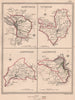


Grouped plans of Reform Act boroughs such as Colchester, Maldon and Harwich, or Bodmin, Launceston, Liskeard and Helston, make Lewis's Topographical Dictionary of England a compact record of English electoral geography after 1832. Samuel Lewis's reference work first appeared in 1831, with later editions represented here through the 1840s, combining historical and statistical descriptions of places with maps of their county and parliamentary settings. The maps were drawn by Creighton and engraved by John and Charles Walker, ranging from a single borough such as Aylesbury to the county maps of Cheshire, Gloucestershire and Berkshire.
EU orders up to €150 are sent VAT- and duty-paid — no additional taxes on arrival
Authenticity Guaranteed - We only sell original antique & vintage items
Can we help? Call us on +44-208-960-3476 • FAQs
All our products are exempt from US tariffs — no additional duties or taxes payable on arrival.


- Shop by Country
- Shop by Cartographer
- Shop Maps by Type
- Shop Prints by Subject