
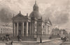


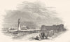
Antique maps, town plans and prints of Liverpool and its Mersey waterfront, including the docks, Pier Head, Town Hall, St George’s Hall, Everton, Toxteth, Wavertree, Aintree, Bootle and views across from Birkenhead. Highlights include early Stockdale, Cole and Roper, SDUK, Tallis, Bacon, Bartholomew and Boundary Commission plans, hydrographic charts of Liverpool Bay, and extensive nineteenth-century street, architectural and port views.
EU orders up to €150 are sent VAT- and duty-paid — no additional taxes on arrival
Authenticity Guaranteed - We only sell original antique & vintage items
Can we help? Call us on +44-208-960-3476 • FAQs
All our products are exempt from US tariffs — no additional duties or taxes payable on arrival.


- Shop by Country
- Shop by Cartographer
- Shop Maps by Type
- Shop Prints by Subject