


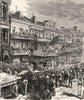


The Mississippi's shifting delta and the streets of New Orleans are at the heart of these maps of Louisiana. French maps by d'Anville and Bellin show a Louisiana extending far beyond the present state, later land-district and parish maps record its divisions, and Colton, Johnson, Bartholomew and Rand McNally contribute state and city maps, with Gulf Coast charts and studies of the river's mouths, passes and cut-offs. Military maps of New Orleans and Port Hudson cover the War of 1812 and the Civil War, and pictorial maps, railways and highway sheets reach the twentieth century. The prints show the levees, cotton steamers, ferries and Canal Street, Mardi Gras processions and Jackson Square.
EU orders up to €150 are sent VAT- and duty-paid — no additional taxes on arrival
Authenticity Guaranteed - We only sell original antique & vintage items
Can we help? Call us on +44-208-960-3476 • FAQs
All our products are exempt from US tariffs — no additional duties or taxes payable on arrival.


- Shop by Country
- Shop by Cartographer
- Shop Maps by Type
- Shop Prints by Subject