


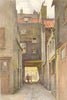
Berkeley Square, Shepherd Market and the streets between Hyde Park and Regent Street fill these maps and prints of Mayfair, a close portrait of one West End district. Horwood's survey of London, Stanford's library sheets and Goad fire-insurance plans record it at different levels of detail, while Booth's poverty map and parliamentary boundaries add its social and administrative geography. The prints show Grosvenor Square, Chesterfield House, Claridge's and the former Curzon Chapel, inside and out, with Shepherd Market by Charles Ginner and Ernest Haslehust and Berkeley Square by William A. Wildman. Cinema seating plans, club maps and fashion advertisements capture the district's leisure and shopping, and road-widening proposals for Park Lane and Piccadilly show London's traffic reshaping its edges.
EU orders up to €150 are sent VAT- and duty-paid — no additional taxes on arrival
Authenticity Guaranteed - We only sell original antique & vintage items
Can we help? Call us on +44-208-960-3476 • FAQs
All our products are exempt from US tariffs — no additional duties or taxes payable on arrival.


- Shop by Country
- Shop by Cartographer
- Shop Maps by Type
- Shop Prints by Subject