


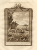


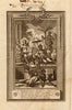


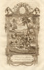


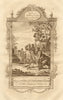


Middleton's System of Geography carried a 1779 London reader around the world, from Batavia and Malacca to Cairo, Jerusalem, Siberia, Japan and Africa. Credited to Charles Theodore Middleton and published for J. Cooke, the work relies on Thomas Bowen for its world and continental maps, while the prints show the cities, inhabitants, monuments and natural history described in the text, including costume and travel scenes, plants, animals and the terrestrial and celestial globes. Some plates reproduce information now known to be wrong, among them an imaginary Philippine island.
EU orders up to €150 are sent VAT- and duty-paid — no additional taxes on arrival
Authenticity Guaranteed - We only sell original antique & vintage items
Can we help? Call us on +44-208-960-3476 • FAQs
All our products are exempt from US tariffs — no additional duties or taxes payable on arrival.


- Shop by Country
- Shop by Cartographer
- Shop Maps by Type
- Shop Prints by Subject