
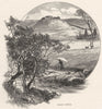


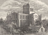




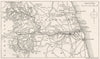


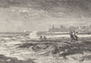

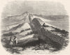


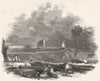


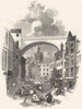




Castles, border roads and the settlements of the Tyne lie at the heart of these antique maps of Northumberland, a county shaped by the Scottish frontier. County and regional sheets set the Cheviot Hills and North Sea coast beside the routes into Scotland, and road maps follow journeys through Newcastle, Morpeth and Berwick. The Newcastle plans associated with John Brand's eighteenth-century history are especially detailed, showing gates, churches, bridges, Roman remains and civic buildings. Later survey and railway maps follow, and the prints range from urban subjects to coastal ruins, country houses and the landscapes around the market towns. Some older maps use the Northumbrian name for a region beyond the modern county.
EU orders up to €150 are sent VAT- and duty-paid — no additional taxes on arrival
Authenticity Guaranteed - We only sell original antique & vintage items
Can we help? Call us on +44-208-960-3476 • FAQs
All our products are exempt from US tariffs — no additional duties or taxes payable on arrival.


- Shop by Country
- Shop by Cartographer
- Shop Maps by Type
- Shop Prints by Subject