


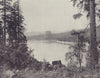


Coastal navigation and westward migration both shape these maps of Oregon in the Pacific Northwest, from Columbia River charts to the Oregon Trail. State and territorial sheets by Colton, Johnson, Mitchell and other atlas publishers record the changing counties, Coast Survey charts examine the Columbia estuary, the Yaquina River, Chetco Cove and smaller anchorages, and railway, highway and pictorial railway maps follow the later routes overland. Geological and wine-region maps add the Coos Bay coalfield and the Eola-Amity Hills. The prints show Portland's waterfront, Astoria, Mount Hood and the falls and rock formations of the Columbia, together with timber rafts and scenes from the Modoc conflict.
EU orders up to €150 are sent VAT- and duty-paid — no additional taxes on arrival
Authenticity Guaranteed - We only sell original antique & vintage items
Can we help? Call us on +44-208-960-3476 • FAQs
All our products are exempt from US tariffs — no additional duties or taxes payable on arrival.


- Shop by Country
- Shop by Cartographer
- Shop Maps by Type
- Shop Prints by Subject