





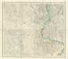


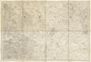


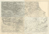


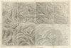
Nineteenth-century Ordnance Survey mapping captured England and Wales lane by lane and hill by hill, and these sheets from the Original Ordnance Survey one-inch series retain the survey's numbering and regional coverage. At one inch to the mile, towns sit within a close network of lanes, rivers and woods, and hachures model the shape of the hills. Coverage ranges from the Kent Downs and Salisbury Plain to the Welsh mountains, the industrial Midlands and northern England, and from the coasts of Portland, Pembrokeshire and Anglesey to the Fens, the Cotswolds and the Pennines. These are successive published sheets rather than a single snapshot, so each impression's edition and revision details show the stage of the landscape it records.
EU orders up to €150 are sent VAT- and duty-paid — no additional taxes on arrival
Authenticity Guaranteed - We only sell original antique & vintage items
Can we help? Call us on +44-208-960-3476 • FAQs
All our products are exempt from US tariffs — no additional duties or taxes payable on arrival.


- Shop by Country
- Shop by Cartographer
- Shop Maps by Type
- Shop Prints by Subject