


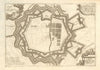


Münster's views of Koblenz, Speyer, Trier, Landau and Mainz open this collection for Rhineland-Palatinate, a region formed only in 1946 from older territories along the Rhine and Moselle. Later maps cover the Palatinate, the Rhenish circles and neighbouring districts, fortification plans and siege maps record Landau and Mainz, and regional sheets follow the Moselle, the Rhine and the Eifel, with wine maps of the two rivers. The prints show abbeys, fountains and other buildings.
EU orders up to €150 are sent VAT- and duty-paid — no additional taxes on arrival
Authenticity Guaranteed - We only sell original antique & vintage items
Can we help? Call us on +44-208-960-3476 • FAQs
All our products are exempt from US tariffs — no additional duties or taxes payable on arrival.


- Shop by Country
- Shop by Cartographer
- Shop Maps by Type
- Shop Prints by Subject