Ignorer et passer au contenu
Votre panier est vide
Continuer les achats

Vous possédez un compte ?

Connectez-vous pour payer plus vite.

Votre panier

Chargement en cours...

Total estimé

£0.00 GBP

Taxes incluses. Réductions et frais d’expédition calculés à l’étape du paiement.
EU orders up to €150 are sent VAT- and duty-paid — no additional taxes on arrival
Authenticity Guaranteed - We only sell original antique & vintage items
Can we help? Call us on +44-208-960-3476 • FAQs
All our products are exempt from US tariffs — no additional duties or taxes payable on arrival.
  • What's New
  • Shop Maps & Prints
    • Shop by Country

    • Shop by Cartographer

    • Shop Maps by Type

    • Shop Prints by Subject

    • Best Maps
    • FAQs
    • Africa
      • South Africa
      • Egypt
      Asia
      • India
      • China
      • Malaysia & Singapore
      • Hong Kong
      • Indonesia
      Australasia
      • Australia
      • New Zealand
    • British Isles
      • England
        • Cornwall
        • Devon
        • Kent
        • Lancashire
        • London
        • Oxfordshire
        • Yorkshire
        • Surrey
        • Sussex
      • Ireland
      • Scotland
      • Wales
    • Europe
      • Austria
      • France
      • Germany
      • Greece
      • Italy
      • Malta
      • Netherlands
      • Norway
      • Poland
      • Portugal
      • Russia
      • Spain
      • Switzerland
    • Middle East
      • Israel / Palestine
      • Iran
      • Saudi Arabia
      North America
      • Canada
      • United States
      • California
      • Florida
      • Illinois
      • New York
      • Pennsylvania
      • Texas
    • Polar Regions South & Central America
      • Mexico
      • Brazil
      Oceans & Islands
      • Pacific
      • Atlantic
      • Caribbean
      • Indian
      World
    • Shop All Countries

    • A-B
      • Admiralty (British)
      • Bacon, George Washington
      • Beck, Harry
      • Bellin, Jacques-Nicolas
      • Booth, Charles
      C-G
      • Cary, John
      • Collins, Greenville
      • Colton, Joseph Hutchins
      • Faden, William
      • Geographia
    • H-J
      • H.M.S.O.
      • Hall, Sidney
      • Hétreau, Rémy
      • Japanese Government Railways
      • Johnson, Alvin Jewett
      K-L
      • Langenes, Barent
      • Lewis, Samuel & Creighton, Roger
      • Keere, Pieter van den
      • Larmat, Louis
      • Lodge, John
    • M-O
      • Mallet, Allain Manesson
      • Moll, Hermann
      • Morden, Robert
      • Munster, Sebastian
      • Ordnance Survey
      P-S
      • Porcacchi, Tomaso
      • Rossi, Giovanni Giacomo de
      • S.D.U.K.
      • Speed, John
      • Stanford, Edward
    • T-V
      • Tallis, John
      • Thomson, John
      • Tolkien, J.R.R.
      • Vandermaelen, Philippe
      • Vaugondy, Robert de
      W-Z
      • Walker, John & Charles
      • Ward Lock & Co
      • Weller, Edward
      • Wyld, James
    • Shop All Cartographers

    • Wine Maps Road Strip Maps Pictorial Maps Town & City Plans
      • Neighbourhood Maps
      • City of London Ward Maps
      • London Parish Maps
      • Insurance Maps
      • London Underground Maps
    • Panoramic Maps Nautical Charts Geological Maps Provincial Maps
      • British Isles County Maps
      • US State Maps
      • French Department Maps
    • Fantasy Maps Star charts Tour de France maps Military Maps
      • American Revolutionary War
      • American Civil War
      • First World War
      • Second World War
    • Animals & Birds
      • Birds
      • Butterflies & Moths
      • Dogs
      • Fish & Marine Animals
      Astronomy & Celestial Botanical & Florals Cartoons, Fantasy & Fairy Tales
      • Flower Fairies
      • Vanity Fair Spy Cartoons
    • Flags & Vexillology Landscapes & Seascapes Military & Naval People, Portraits & Fashion
      • Celebrities & Royalty
      • Children & Family
      • Fashion & Traditional Dress
      • Religion
      • Society
      • Tribal
    • Religious Buildings Ships & Maritime Sports & Hobbies
      • Golf
      • Cricket
      • Riding, Hunting & Shooting
      • Horse Racing & Jockeys
      • Sailing
      • Rowing
      • Polo
      • Athletics
    • Trade & Professions
      • Business & Industry
      • Education
      • Engineering & Science
      • Farming & Fishermen
      • Law
      • Literary
      • Medicine
      • Performing Arts
      Town Views
    • Shop All Subjects

  • About
  • Contact
Antiquemapsandprints.com Antiquemapsandprints.com
  • Panier
Antiquemapsandprints.com
  • Shop by Country
    • Shop All Countries
    • Africa
      • South Africa
      • Egypt
    • Asia
      • India
      • China
      • Malaysia & Singapore
      • Hong Kong
      • Indonesia
    • Australasia
      • Australia
      • New Zealand
    • British Isles
      • England
        • Cornwall
        • Devon
        • Kent
        • Lancashire
        • London
        • Oxfordshire
        • Yorkshire
        • Surrey
        • Sussex
      • Ireland
      • Scotland
      • Wales
    • Europe
      • Austria
      • France
      • Germany
      • Greece
      • Italy
      • Malta
      • Netherlands
      • Norway
      • Poland
      • Portugal
      • Russia
      • Spain
      • Switzerland
    • Middle East
      • Israel / Palestine
      • Iran
      • Saudi Arabia
    • North America
      • Canada
      • United States
      • California
      • Florida
      • Illinois
      • New York
      • Pennsylvania
      • Texas
    • Polar Regions
    • South & Central America
      • Mexico
      • Brazil
    • Oceans & Islands
      • Pacific
      • Atlantic
      • Caribbean
      • Indian
    • World
  • Shop by Cartographer
    • Shop All Cartographers
    • A-B
      • Admiralty (British)
      • Bacon, George Washington
      • Beck, Harry
      • Bellin, Jacques-Nicolas
      • Booth, Charles
    • C-G
      • Cary, John
      • Collins, Greenville
      • Colton, Joseph Hutchins
      • Faden, William
      • Geographia
    • H-J
      • H.M.S.O.
      • Hall, Sidney
      • Hétreau, Rémy
      • Japanese Government Railways
      • Johnson, Alvin Jewett
    • K-L
      • Langenes, Barent
      • Lewis, Samuel & Creighton, Roger
      • Keere, Pieter van den
      • Larmat, Louis
      • Lodge, John
    • M-O
      • Mallet, Allain Manesson
      • Moll, Hermann
      • Morden, Robert
      • Munster, Sebastian
      • Ordnance Survey
    • P-S
      • Porcacchi, Tomaso
      • Rossi, Giovanni Giacomo de
      • S.D.U.K.
      • Speed, John
      • Stanford, Edward
    • T-V
      • Tallis, John
      • Thomson, John
      • Tolkien, J.R.R.
      • Vandermaelen, Philippe
      • Vaugondy, Robert de
    • W-Z
      • Walker, John & Charles
      • Ward Lock & Co
      • Weller, Edward
      • Wyld, James
  • Shop Maps by Type
    • Wine Maps
    • Road Strip Maps
    • Pictorial Maps
    • Town & City Plans
      • Neighbourhood Maps
      • City of London Ward Maps
      • London Parish Maps
      • Insurance Maps
      • London Underground Maps
    • Panoramic Maps
    • Nautical Charts
    • Geological Maps
    • Provincial Maps
      • British Isles County Maps
      • US State Maps
      • French Department Maps
    • Fantasy Maps
    • Star charts
    • Tour de France maps
    • Military Maps
      • American Revolutionary War
      • American Civil War
      • First World War
      • Second World War
  • Shop Prints by Subject
    • Shop All Subjects
    • Animals & Birds
      • Birds
      • Butterflies & Moths
      • Dogs
      • Fish & Marine Animals
    • Astronomy & Celestial
    • Botanical & Florals
    • Cartoons, Fantasy & Fairy Tales
      • Flower Fairies
      • Vanity Fair Spy Cartoons
    • Flags & Vexillology
    • Landscapes & Seascapes
    • Military & Naval
    • People, Portraits & Fashion
      • Celebrities & Royalty
      • Children & Family
      • Fashion & Traditional Dress
      • Religion
      • Society
      • Tribal
    • Religious Buildings
    • Ships & Maritime
    • Sports & Hobbies
      • Golf
      • Cricket
      • Riding, Hunting & Shooting
      • Horse Racing & Jockeys
      • Sailing
      • Rowing
      • Polo
      • Athletics
    • Trade & Professions
      • Business & Industry
      • Education
      • Engineering & Science
      • Farming & Fishermen
      • Law
      • Literary
      • Medicine
      • Performing Arts
    • Town Views
  • Best Maps
  • What's New
  • About
  • Contact
  • Account

South America

  • Forrest, Archibald Stevenson
  • Brazil
  • Argentina
Filtrer
Effacer
Filtrer
Filtrer
Trier
Tout supprimer

Showing 907 of 907 products Showing 907 of 907

Trier
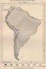
  • Isothermal lines of South America 1885 old antique vintage map plan chart Isothermal lines of South America 1885 old antique vintage map plan chart
    Isothermal lines of South America 1885 old antique vintage map plan chart

    £11.00

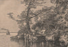
  • Landing stage on the Magdalena, near the Sogamoso confluence. Colombia 1885 Landing stage on the Magdalena, near the Sogamoso confluence. Colombia 1885
    Landing stage on the Magdalena, near the Sogamoso confluence. Colombia 1885

    £11.00

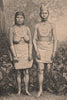
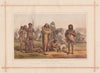
  • Muysca/Muisca Indians, adorned with antique jewellery. Colombia 1885 old print Muysca/Muisca Indians, adorned with antique jewellery. Colombia 1885 old print
    Muysca/Muisca Indians, adorned with antique jewellery. Colombia 1885 old print

    £11.00

  • SOUTH AMERICA. Argentina, Chile, Paraguay, and Uruguay 1910 old antique map SOUTH AMERICA. Argentina, Chile, Paraguay, and Uruguay 1910 old antique map
    SOUTH AMERICA. Argentina, Chile, Paraguay, and Uruguay 1910 old antique map

    £11.00

  • SOUTH AMERICA. Britannica 9th edition 1898 old antique vintage map plan chart SOUTH AMERICA. Britannica 9th edition 1898 old antique vintage map plan chart
    SOUTH AMERICA. Britannica 9th edition 1898 old antique vintage map plan chart

    £11.00

  • SOUTH AMERICA. North-west; map of Galapagos Isles 1907 old antique chart SOUTH AMERICA. North-west; map of Galapagos Isles 1907 old antique chart
    SOUTH AMERICA. North-west; map of Galapagos Isles 1907 old antique chart

    £11.00

  • SOUTH BRAZIL URUGUAY. Lighthouses. Bahia Minas Gerais Sao Paolo. LETTS 1883 map SOUTH BRAZIL URUGUAY. Lighthouses. Bahia Minas Gerais Sao Paolo. LETTS 1883 map
    SOUTH BRAZIL URUGUAY. Lighthouses. Bahia Minas Gerais Sao Paolo. LETTS 1883 map

    £11.00

  • SOUTH BRAZIL URUGUAY. Lighthouses. Bahia Minas Gerais Sao Paolo. LETTS 1884 map SOUTH BRAZIL URUGUAY. Lighthouses. Bahia Minas Gerais Sao Paolo. LETTS 1884 map
    SOUTH BRAZIL URUGUAY. Lighthouses. Bahia Minas Gerais Sao Paolo. LETTS 1884 map

    £11.00

  • SOUTH BRAZIL URUGUAY. Lighthouses. Bahia Minas Gerais Sao Paolo. LETTS 1889 map SOUTH BRAZIL URUGUAY. Lighthouses. Bahia Minas Gerais Sao Paolo. LETTS 1889 map
    SOUTH BRAZIL URUGUAY. Lighthouses. Bahia Minas Gerais Sao Paolo. LETTS 1889 map

    £11.00

  • SOUTH BRAZIL URUGUAY. Lighthouses. Bahia Minas Gerais Sao Paolo. LETTS 1892 map SOUTH BRAZIL URUGUAY. Lighthouses. Bahia Minas Gerais Sao Paolo. LETTS 1892 map
    SOUTH BRAZIL URUGUAY. Lighthouses. Bahia Minas Gerais Sao Paolo. LETTS 1892 map

    £11.00

  • South America #3. Argentina Chile Patagonia Paraguay. BARTHOLOMEW 1888 old map South America #3. Argentina Chile Patagonia Paraguay. BARTHOLOMEW 1888 old map
    South America #3. Argentina Chile Patagonia Paraguay. BARTHOLOMEW 1888 old map

    £11.00

  • South America #3. Argentina Chile Patagonia Paraguay. BARTHOLOMEW 1893 old map South America #3. Argentina Chile Patagonia Paraguay. BARTHOLOMEW 1893 old map
    South America #3. Argentina Chile Patagonia Paraguay. BARTHOLOMEW 1893 old map

    £11.00

  • South America. Argentine Republic Chile Uruguay. BARTHOLOMEW 1904 old map South America. Argentine Republic Chile Uruguay. BARTHOLOMEW 1904 old map
    South America. Argentine Republic Chile Uruguay. BARTHOLOMEW 1904 old map

    £11.00

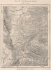
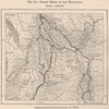
  • The Raspadura divide. Colombia 1885 old antique vintage map plan chart The Raspadura divide. Colombia 1885 old antique vintage map plan chart
    The Raspadura divide. Colombia 1885 old antique vintage map plan chart

    £11.00

  • ANDEAN STATES w/ Ecuadorian–Peruvian War (Guerra del 41) border changes 1947 map ANDEAN STATES w/ Ecuadorian–Peruvian War (Guerra del 41) border changes 1947 map
    ANDEAN STATES w/ Ecuadorian–Peruvian War (Guerra del 41) border changes 1947 map

    £10.50

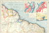
  • BRAZIL NORTH COAST & GUIANAS. Inset Recife & Salvador de Bahia plans 1920 map BRAZIL NORTH COAST & GUIANAS. Inset Recife & Salvador de Bahia plans 1920 map
    BRAZIL NORTH COAST & GUIANAS. Inset Recife & Salvador de Bahia plans 1920 map

    £10.50

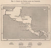
  • Canals and routes across the Isthmuses. Central America. Panama 1885 old map Canals and routes across the Isthmuses. Central America. Panama 1885 old map
    Canals and routes across the Isthmuses. Central America. Panama 1885 old map

    £10.50

  • Goajira/Goajira Peninsula. Macuira. Riohacha. Colombia 1885 old antique map Goajira/Goajira Peninsula. Macuira. Riohacha. Colombia 1885 old antique map
    Goajira/Goajira Peninsula. Macuira. Riohacha. Colombia 1885 old antique map

    £10.50

  • La Mojana. Magdalena inland delta. Magangue El Banco. Colombia 1885 old map La Mojana. Magdalena inland delta. Magangue El Banco. Colombia 1885 old map
    La Mojana. Magdalena inland delta. Magangue El Banco. Colombia 1885 old map

    £10.50

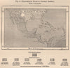
  • Predominant races in Central America 1885 old antique vintage map plan chart Predominant races in Central America 1885 old antique vintage map plan chart
    Predominant races in Central America 1885 old antique vintage map plan chart

    £10.50

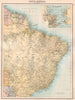
  • SOUTH AMERICA NE. Brazil. Guyana. inset Rio de Janeiro. BARTHOLOMEW 1898 map SOUTH AMERICA NE. Brazil. Guyana. inset Rio de Janeiro. BARTHOLOMEW 1898 map
    SOUTH AMERICA NE. Brazil. Guyana. inset Rio de Janeiro. BARTHOLOMEW 1898 map

    £10.50

  • SOUTH AMERICA NORTH-WEST. Colombia Ecuador Peru Panama. BARTHOLOMEW 1952 map SOUTH AMERICA NORTH-WEST. Colombia Ecuador Peru Panama. BARTHOLOMEW 1952 map
    SOUTH AMERICA NORTH-WEST. Colombia Ecuador Peru Panama. BARTHOLOMEW 1952 map

    £10.50

  • SOUTH AMERICA. Bolivia with littoral/sea coast. Patagonia. BARTHOLOMEW 1876 map SOUTH AMERICA. Bolivia with littoral/sea coast. Patagonia. BARTHOLOMEW 1876 map
    SOUTH AMERICA. Bolivia with littoral/sea coast. Patagonia. BARTHOLOMEW 1876 map

    £10.50

  • South America. Physical. Mountains & rivers 1886 old antique map plan chart South America. Physical. Mountains & rivers 1886 old antique map plan chart
    South America. Physical. Mountains & rivers 1886 old antique map plan chart

    £10.50

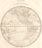
  • WESTERN HEMISPHERE.North America South America.(Oxford Encyclopaedia) 1830 map WESTERN HEMISPHERE.North America South America.(Oxford Encyclopaedia) 1830 map
    WESTERN HEMISPHERE.North America South America.(Oxford Encyclopaedia) 1830 map

    £10.50

  • Eruption of Coseguina. Central America. Sketch map 1886 old antique chart Eruption of Coseguina. Central America. Sketch map 1886 old antique chart
    Eruption of Coseguina. Central America. Sketch map 1886 old antique chart

    £10.00

  • Honda and la Dorada Railway. Rio Magdalena. Colombia 1885 old antique map Honda and la Dorada Railway. Rio Magdalena. Colombia 1885 old antique map
    Honda and la Dorada Railway. Rio Magdalena. Colombia 1885 old antique map

    £10.00

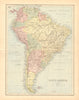
  • MAPS. South America 1870 old antique vintage plan chart MAPS. South America 1870 old antique vintage plan chart
    MAPS. South America 1870 old antique vintage plan chart

    £10.00

  • ABORIGINES OF SOUTH AMERICA. Botocudos Brazil Patagonia Tierra del Fuego 1882 ABORIGINES OF SOUTH AMERICA. Botocudos Brazil Patagonia Tierra del Fuego 1882
    ABORIGINES OF SOUTH AMERICA. Botocudos Brazil Patagonia Tierra del Fuego 1882

    £9.50

  • ARGENTINA CHILE URUGUAY. Inset Lima Valparaiso Buenos Aires Montevideo 1909 map ARGENTINA CHILE URUGUAY. Inset Lima Valparaiso Buenos Aires Montevideo 1909 map
    ARGENTINA CHILE URUGUAY. Inset Lima Valparaiso Buenos Aires Montevideo 1909 map

    £9.50

  • ARGENTINA. Boating on the Tigray, near Buenos Aires 1908 old antique print ARGENTINA. Boating on the Tigray, near Buenos Aires 1908 old antique print
    ARGENTINA. Boating on the Tigray, near Buenos Aires 1908 old antique print

    £9.50

  • BRAZIL SOUTH. Minas Geraes Bahia Parana Espirito Santo.Inset Sao Paulo 1920 map BRAZIL SOUTH. Minas Geraes Bahia Parana Espirito Santo.Inset Sao Paulo 1920 map
    BRAZIL SOUTH. Minas Geraes Bahia Parana Espirito Santo.Inset Sao Paulo 1920 map

    £9.50

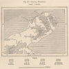
  • Parallelism of the old & recent Watercourses.Belize.British Honduras 1885 map Parallelism of the old & recent Watercourses.Belize.British Honduras 1885 map
    Parallelism of the old & recent Watercourses.Belize.British Honduras 1885 map

    £9.50

  • SOUTH AMERICA COMMERCIAL.Steamer routes Telegraph cables Railways 1912 old map SOUTH AMERICA COMMERCIAL.Steamer routes Telegraph cables Railways 1912 old map
    SOUTH AMERICA COMMERCIAL.Steamer routes Telegraph cables Railways 1912 old map

    £9.50

  • SOUTH AMERICA COMMERCIAL.Steamer routes Telegraph cables Railways Canal 1901 map SOUTH AMERICA COMMERCIAL.Steamer routes Telegraph cables Railways Canal 1901 map
    SOUTH AMERICA COMMERCIAL.Steamer routes Telegraph cables Railways Canal 1901 map

    £9.50

  • SOUTH AMERICA NORTHERN. Physical map; Inset map of Rio de Janiero 1909 old SOUTH AMERICA NORTHERN. Physical map; Inset map of Rio de Janiero 1909 old
    SOUTH AMERICA NORTHERN. Physical map; Inset map of Rio de Janiero 1909 old

    £9.50

  • 1
  • …
  • 8
  • 9
  • 10
  • 11
  • 12
  • …
  • 26
Back to Top

Be the first to explore our new discoveries.

Sign up for early access to rare finds and special offers.

2026 Antiqua Print Gallery Ltd. All rights Reserved.
  • Antiqua Print Gallery Ltd
    • Suite 204, Cumberland House 80 Scrubs Lane London NW10 6RF
    • +44 (0)208 960 3476
    • info@antiquemapsandprints.com
  • Shop By
    • Country
    • Cartographer
    • Subject
  • Discover
    • About Us
    • Blog
    • Contact Us
    • Sell to Us
    • FAQs
  • Social
    • Facebook
    • Instagram
    • Pinterest
  • Privacy Policy
  • Cookies
  • Returns
  • Delivery
  • Terms & Conditions
  • Website by Radiant
    • Website by Radiant
    • Privacy Policy
    • Cookies
    • Returns
    • Delivery
    • Terms & Conditions
  • Moyens de paiement
    • American Express
    • Apple Pay
    • Bancontact
    • Diners Club
Moyens de paiement
  • American Express
  • Apple Pay
  • Bancontact
  • Diners Club
2026 Antiqua Print Gallery Ltd. All rights Reserved.
  • Le choix d'une sélection entraîne l'actualisation de la page entière.
  • S'ouvre dans une nouvelle fenêtre.