


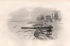


Maps and prints of Southampton, its docks, waterfront, ancient gates, Bargate, Portswood, Northam, Woolston and the River Itchen. The collection includes town plans by Bacon, Dawson and Ward Lock, Admiralty and Solent charts, parliamentary boundary maps, dock engineering plans and extensive nineteenth-century views from The Picture of Southampton, together with scenes of royal arrivals, shipping, civic buildings and nearby Netley.
EU orders up to €150 are sent VAT- and duty-paid — no additional taxes on arrival
Authenticity Guaranteed - We only sell original antique & vintage items
Can we help? Call us on +44-208-960-3476 • FAQs
All our products are exempt from US tariffs — no additional duties or taxes payable on arrival.


- Shop by Country
- Shop by Cartographer
- Shop Maps by Type
- Shop Prints by Subject