


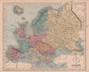


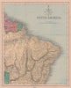


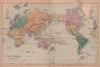


Railways, empires and comparative charts of the world's great rivers and mountains come together in The Modern Atlas of The Earth, William Hughes's Victorian survey of the globe. Published by Frederick Warne in London, the atlas is represented by nineteenth-century sheets of Europe, Asia, Africa, the Americas and Australasia, with regional maps of British India, the Ottoman territories and the Australian colonies, and European maps reflecting changing frontiers around Germany, France and the Balkans. Thematic plates compare rivers, mountains, lakes and waterfalls or chart ocean currents and temperature, and a Mercator world map credited to John Dower is included. Palestine appears in both ancient and modern form.
EU orders up to €150 are sent VAT- and duty-paid — no additional taxes on arrival
Authenticity Guaranteed - We only sell original antique & vintage items
Can we help? Call us on +44-208-960-3476 • FAQs
All our products are exempt from US tariffs — no additional duties or taxes payable on arrival.


- Shop by Country
- Shop by Cartographer
- Shop Maps by Type
- Shop Prints by Subject