


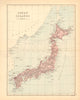

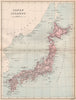


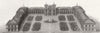


Edo's waterways and the modernising streets of Tokyo meet in these maps, which follow the Japanese capital under its successive names. Early maps by Mallet and Bellin give way to harbour surveys, provincial maps and detailed plans of neighbourhoods such as Asakusa, Shiba and Nihonbashi, with parks, railway approaches and the bay treated separately. The Great Kantō earthquake produced specialist sheets of fires, damaged districts, relief depots and reconstruction schemes, and wartime maps record the bombing and wider Japanese military geography. The prints show the imperial precinct, temples, bridges, canals and commercial streets, as well as diplomatic incidents and naval visits.
EU orders up to €150 are sent VAT- and duty-paid — no additional taxes on arrival
Authenticity Guaranteed - We only sell original antique & vintage items
Can we help? Call us on +44-208-960-3476 • FAQs
All our products are exempt from US tariffs — no additional duties or taxes payable on arrival.


- Shop by Country
- Shop by Cartographer
- Shop Maps by Type
- Shop Prints by Subject