


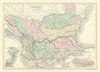








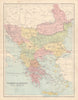

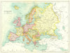

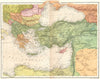


Anatolia, the Bosphorus and the old Ottoman lands give these maps of Turkey a reach well beyond the modern frontiers. The examples include d'Anville's Asia Minor, a Times sheet of Constantinople and the Sea of Marmara, and Tallis and Rapkin's Turkey in Asia, while other maps cover what older atlases called Ottoman provinces, among them parts of the Balkans and the eastern Mediterranean, so a single sheet may cross several present-day borders. Regional maps relate seas, routes and settlements, and city and straits maps bring strategic geography into close view. Prints accompany the maps, which span early geographical works to the twentieth century.
EU orders up to €150 are sent VAT- and duty-paid — no additional taxes on arrival
Authenticity Guaranteed - We only sell original antique & vintage items
Can we help? Call us on +44-208-960-3476 • FAQs
All our products are exempt from US tariffs — no additional duties or taxes payable on arrival.


- Shop by Country
- Shop by Cartographer
- Shop Maps by Type
- Shop Prints by Subject