
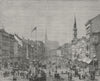

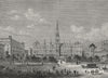

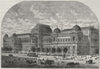

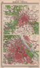

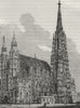
Maps and prints of Vienna include SDUK, Bradshaw, Letts and Baedeker plans, Johnston city-and-environs sheets, and official Allied occupation mapping. Views and architectural plans cover the Graben, Hofburg, Schönbrunn, Belvedere, Prater, St Stephen’s Cathedral, museums, markets and public buildings, alongside Danube regulation maps and illustrated scenes of exhibitions, ceremonies and daily Viennese life.
EU orders up to €150 are sent VAT- and duty-paid — no additional taxes on arrival
Authenticity Guaranteed - We only sell original antique & vintage items
Can we help? Call us on +44-208-960-3476 • FAQs
All our products are exempt from US tariffs — no additional duties or taxes payable on arrival.


- Shop by Country
- Shop by Cartographer
- Shop Maps by Type
- Shop Prints by Subject