


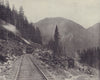


Puget Sound, the Columbia River and the Cascade Mountains shape the maps and prints of Washington State, from early coastal surveys to pictorial maps of the twentieth century. United States Coast Survey sheets of 1860 to 1881 and later Admiralty charts follow the channels and harbours around Seattle, Port Madison and Admiralty Inlet, and a map of 1885 traces the boundary through the San Juan Archipelago. Johnson's territorial map of 1861 and later state maps by Cram, Rand McNally and others record counties, railways and reservations, Charles Royce's maps of 1899 trace Indian land cessions, and Ruth Taylor White gives the state a pictorial treatment in 1935. Prints show Seattle, Tacoma and Spokane, Snoqualmie Falls, Mount Rainier, salmon fishing on the Columbia, the lumber mill at Port Blakely and the Great Northern switchback in the Cascades. A Convair map of 1961 plots Atlas missile sites around Spokane.
EU orders up to €150 are sent VAT- and duty-paid — no additional taxes on arrival
Authenticity Guaranteed - We only sell original antique & vintage items
Can we help? Call us on +44-208-960-3476 • FAQs
All our products are exempt from US tariffs — no additional duties or taxes payable on arrival.


- Shop by Country
- Shop by Cartographer
- Shop Maps by Type
- Shop Prints by Subject