South Georgia - Territorial Sea Baseline. Admiralty sea chart #3597. 1958 (1990) map
SKU
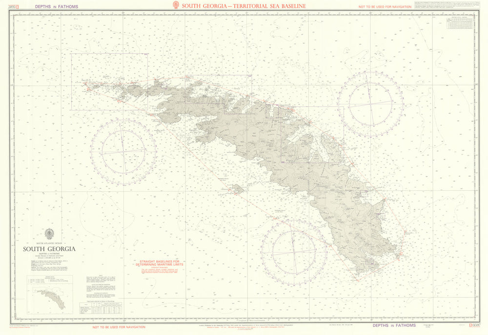
'South Atlantic Ocean - South Georgia - Territorial Sea Baseline'
This chart of South Georgia features a red overprint marking the territorial baseline limits defined in the South Georgia and South Sandwich Islands (Territorial Sea) Order 1989. This legal document, issued by the United Kingdom, established the territorial sea boundaries for South Georgia and the South Sandwich Islands, British Overseas Territories in the South Atlantic Ocean. It specified straight baselines and limits to determine the extent of territorial waters, generally extending up to 12 nautical miles from the baselines, in accordance with international law, particularly the United Nations Convention on the Law of the Sea (UNCLOS). By delineating these baselines and territorial waters, the UK reinforced its sovereignty over the islands and their surrounding maritime zones, which hold importance for fishing, environmental protection, and potential resource exploration. The order was issued in the wake of the Falklands War of 1982, reflecting the UK’s efforts to strengthen legal and administrative control over its South Atlantic territories, reaffirm sovereignty, and establish clear maritime boundaries.
Browse available examples:
Size 70 x 102 cm | 27.5 x 40.0 inches
Date Published: First published 1958. This edition 1990. Small corrections to 1990
Type: Large British nautical sea chart. Sea charts such as this were working navigational aids which were commonly updated and corrected during their working lives by hand annotation and/or printed overlays. They may also feature manuscript navigational notes, comments or other markings
Author: British Admiralty
Publication: British Admiralty
Condition: Good |
Delivery & Returns
Packing
Items smaller than A4 size are usually packed in a stiffened, board-backed envelope. Larger items are rolled and packed in postal tubes. Large items which are too stiff to be rolled in wide-diameter tubes are mailed in all-board envelopes. In the unlikely event of damage in transit, please send the affected item or items back to us and we will provide a replacement or refund.
Delivery
Economy, tracked and express shipping options are available to all destinations worldwide. Over half our orders are sent to customers outside the United Kingdom and we have supplied over 30,000 buyers in over 70 different countries. We ship orders virtually every business day to customers in North America and Europe. The cost of delivery depends on the size of the largest item in your order, where you are located, and the delivery method that you choose at checkout. For orders received before 2pm, we can arrange delivery next day in the UK, within 2 business days to continental Europe and North America, and within 4 days to most other countries worldwide (excludes PO Box or APO/FPO (Military) addresses).
Returns
We accept returns for any reason if sent back to us within 14 days of receipt of your order. If any of your items are not as described, we will provide a full refund including reasonable return postage costs upon safe return to us. If you have changed your mind, you are responsible for the cost of returning the item to us. We describe the size, age and condition of all our products as fully and accurately as possible. Most of the items which we sell are in very good condition. However, the condition of antique and vintage prints and maps can vary. All of our product listings including a statement which classifies the condition as being either “Good”, “Fair”, or (rarely) “Poor” and which describes any material flaws, blemishes, imperfections or other significant features such as folds. Please read the description carefully before purchase.
Can we help? For more details or any questions.