


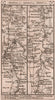


Ashford is the Kent market town on the old road from London to Hythe, and that road runs through its maps from the earliest: John Ogilby's strip of 1675, then Thomas Gardner's, Owen and Bowen's, and Daniel Paterson's stages through Maidstone to Mersham. County sheets by Cary and later mapmakers set the town between Canterbury, Romney Marsh and the Weald, and a Boundary Commission map of 1885 shows its parliamentary division. J. W. R. Adams's planning maps of 1948 chart shopping catchments, roads and farmland, and the Headley Brothers plan of 1962 shows the streets of a town enlarged by its railway junction and works. Among the prints, Shepherd's view of 1829 catches market day beside St Mary's Church, and an Edwardian print shows Goddington Park.
EU orders up to €150 are sent VAT- and duty-paid — no additional taxes on arrival
Authenticity Guaranteed - We only sell original antique & vintage items
Can we help? Call us on +44-208-960-3476 • FAQs
All our products are exempt from US tariffs — no additional duties or taxes payable on arrival.


- Shop by Country
- Shop by Cartographer
- Shop Maps by Type
- Shop Prints by Subject