
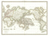


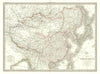




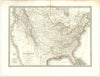


Ancient Gaul, the modern political world and the celestial hemispheres share the pages of Atlas Universel de Geographie Ancienne et Moderne, by Pierre Lapie and his son Alexandre-Émile Lapie, published in Paris by Eymery, Fruger and their associates. The maps are dated between 1828 and 1836, and the title-page date does not necessarily match the latest state of each sheet. Modern regional maps cover the British Isles, Switzerland, North Africa, China and the Americas, historical maps turn to Gaul and the invasions that changed Europe, and world maps use both paired hemispheres and Mercator's projection, giving the atlas its educational sweep across history, politics and cosmography.
EU orders up to €150 are sent VAT- and duty-paid — no additional taxes on arrival
Authenticity Guaranteed - We only sell original antique & vintage items
Can we help? Call us on +44-208-960-3476 • FAQs
All our products are exempt from US tariffs — no additional duties or taxes payable on arrival.


- Shop by Country
- Shop by Cartographer
- Shop Maps by Type
- Shop Prints by Subject