
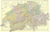


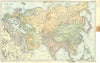

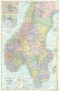


Harbour insets and comparisons of shipping, population and military strength show how trade and empire bound the world of 1905 together in the Bacon Atlas. Bacon's Geographical Establishment published it, and the sheets here range from Europe to the Americas and Asia. Switzerland, Canada and the German Empire appear beside Persia, Afghanistan and the Persian Gulf, selected city and harbour insets give closer detail, and statistical maps of national finances complete a reference work made in the years before the First World War.
EU orders up to €150 are sent VAT- and duty-paid — no additional taxes on arrival
Authenticity Guaranteed - We only sell original antique & vintage items
Can we help? Call us on +44-208-960-3476 • FAQs
All our products are exempt from US tariffs — no additional duties or taxes payable on arrival.


- Shop by Country
- Shop by Cartographer
- Shop Maps by Type
- Shop Prints by Subject