


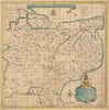


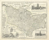


From the lathes of Kent to the harbour of Veracruz and the islands of the Caribbean, these maps by Emanuel Bowen were all published in the middle decades of the eighteenth century. The Kent sheets also cover the diocese of Canterbury, and a map of London reconstructs the City and its liberties in relation to the Great Fire of 1666. The Netherlands, Antigua and the wider West Indies complete the range, with the Veracruz plan showing the city’s coastal defences.
EU orders up to €150 are sent VAT- and duty-paid — no additional taxes on arrival
Authenticity Guaranteed - We only sell original antique & vintage items
Can we help? Call us on +44-208-960-3476 • FAQs
All our products are exempt from US tariffs — no additional duties or taxes payable on arrival.


- Shop by Country
- Shop by Cartographer
- Shop Maps by Type
- Shop Prints by Subject