


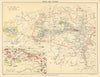


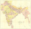


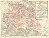


Presidencies, railways and older regional names give these maps of British India a clearly historical framework. They cover Bombay, Madras, Lower Bengal and northern India, with Mysore, Gujarat, Kashmir and Punjab among the named areas, and some sheets extend to Ceylon or territories now in Pakistan, Bangladesh and Myanmar, following the coverage of contemporary atlases rather than modern borders. Comparing editions shows changes in transport and territorial description, and the collection runs from the nineteenth century into later retrospective or reference material. Prints accompany the maps.
EU orders up to €150 are sent VAT- and duty-paid — no additional taxes on arrival
Authenticity Guaranteed - We only sell original antique & vintage items
Can we help? Call us on +44-208-960-3476 • FAQs
All our products are exempt from US tariffs — no additional duties or taxes payable on arrival.


- Shop by Country
- Shop by Cartographer
- Shop Maps by Type
- Shop Prints by Subject