


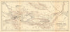


Bukhara, the Aral Sea and the routes to the Chinese frontier give these maps of Central Asia their sweep, across material from the sixteenth century to the twentieth. Earlier sheets use broad terms such as Tartary and Independent Tartary, while later maps distinguish khanates, Russian acquisitions and Soviet republics. Survey and expedition material follows journeys across Turkestan, the Kuldja district and neighbouring territories, archaeological maps of northern Afghanistan add ancient sites, and wider regional maps take in the Caspian, Siberia, Persia and western China. The prints show clothing, tents and inhabitants as earlier travellers recorded them.
EU orders up to €150 are sent VAT- and duty-paid — no additional taxes on arrival
Authenticity Guaranteed - We only sell original antique & vintage items
Can we help? Call us on +44-208-960-3476 • FAQs
All our products are exempt from US tariffs — no additional duties or taxes payable on arrival.


- Shop by Country
- Shop by Cartographer
- Shop Maps by Type
- Shop Prints by Subject