
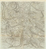


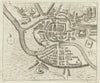


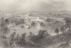
Richard Benning’s eighteenth-century plan and a reconstruction of the medieval city are among the highlights of these antique maps and prints of Bristol. The historical plans published with William Barrett’s history of the city in 1789 include a version after Speed and the medieval reconstruction, and Alfred Edward Taylor’s pictorial plan brings the mapping into the twentieth century, while older county descriptions place Bristol between Gloucestershire and Somerset. The prints range from a view of the cathedral to broad prospects from British travel books, including Bartlett’s drawing from Rownham Ferry, and a sheet shared with Bath.
EU orders up to €150 are sent VAT- and duty-paid — no additional taxes on arrival
Authenticity Guaranteed - We only sell original antique & vintage items
Can we help? Call us on +44-208-960-3476 • FAQs
All our products are exempt from US tariffs — no additional duties or taxes payable on arrival.


- Shop by Country
- Shop by Cartographer
- Shop Maps by Type
- Shop Prints by Subject